Books & Maps
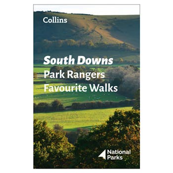
Walking guide to the South Downs National Park, with 20 best routes chosen by the park rangers. Each walk varies in length from 2 to 10 km and can be completed in less than 4 hours. 20 best routes chosen and written by National Park rangers.
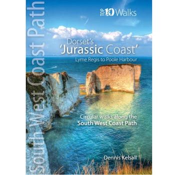
The ten walks featured here highlight the best short circular walks along Dorset's iconic 'Jurassic Coast' section of the South West Coast Path. The Dorset coast is perhaps the most varied of the whole south western peninsula, encompassing glorious beaches, towering cliffs, detached stacks, long shingle banks and picturesque coves and inlets. The handiwork of man both past and present is there too, in settlement, quarrying and even oil extraction. But there is little to detract from the coast's overall beauty - and the coast's huge range of habitats is reflected in the sheer abundance of flowers and wildlife you'll experience along the way.
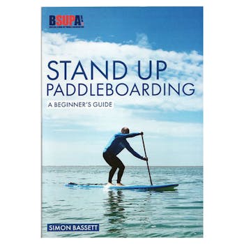
Stand Up Paddleboarding is the fastest growing watersport worldwide. The comparatively low cost, the convenience of inflatable boards and the fact that you can just get on and go all add up to its appeal. But, as with everything, a little bit of knowledge and technique makes the experience so much more enjoyable! That is where this book - the first UK how-to book on paddleboarding - comes in. It provides a perfect introduction to the sport: how to paddleboard, what kit to use and where to go. The book guides you through launching, the correct stance, paddling in a straight line, the different types of turns and landing. It shows you how to choose your board and paddle, inflate and deflate an inflatable board, and talks about where to ride as well as weather, safety, maintenance and repair of your equipment. It covers the main types of paddleboarding: touring, racing, surfing and yoga / fitness. All aspects are heavily illustrated with colour photographs and diagrams making it easy to understand and clear to follow.
Explore East Sussex's most picturesque region, from the South Downs National park and Seven Sisters to deep into the High Weald.

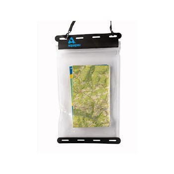
Whether you’re walking in the hills or kayaking, The Aquapac Waterproof Map Case will keep your maps safe, dry and always at hand.
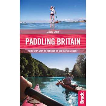
Paddling Britain: 50 Best Places to Explore by SUP, Kayak & Canoe
The author, Lizzie Carr, says: 'This book responds to the countless questions I receive regularly from paddleboarders looking to explore new places and get new experiences from their SUP. Whether people want to take their families for a weekend adventure or enjoy a camping getaway with friends, this book - the first SUP guide on the market - aims to answer these questions and inspire people to get outside and explore the UK water scene both coastal and inland.'
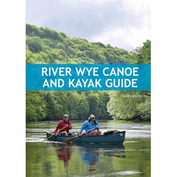
The Wye is one of Britain's finest canoe and kayak touring rivers, and offers something for every kind of paddler. This guide provides the information and advice you need to plan your own Wye journey, whether it's a single or multi-day trip, whitewater or sedate cruising. The author, Mark Rainsley, has divided the river into 15 sections, which are described in detail with distances, grades, access points and campsites. These sections can be paddled as single-day trips, or combined into multi-day adventures, and there are suggested itineraries for both whitewater and touring expeditions that range from 3 to 5 days. To help you plan your journey there is advice on equipment, safety and access, as well as information on wildlife, culture and landscape. Mark Rainsley has spent three decades using paddlesport as a means of avoiding adulthood and responsibility. He is a fanatical paddler who has descended challenging whitewater rivers worldwide, and who is dedicated to exploring every nook and cranny of the UK's coast by sea kayak. He created the UK Rivers and UK Sea Kayak websites and is a prolific contributor to paddlesport magazines and other media. Mark authored the Pesda Press guidebook South West Sea Kayaking, and has contributed to other Pesda titles such as English Whitewater and South East England and Channel Islands Sea Kayaking.
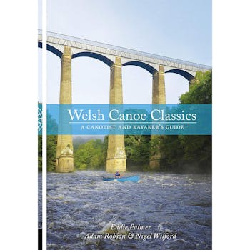
Welsh Canoe Classics is an illustrated guide to some of the finest tours of Wales' waterways. Scenic lakes, broad estuaries and whitewater rivers, as they can only be seen from canoe or kayak. Eddie, Adam and Wilf have chosen the best inland touring routes which are described in great detail and illustrated with numerous colour photos and maps. The selected routes are suitable for open canoes, sit-on-tops and touring kayaks, and include seven whitewater trips. Many of them can be tackled as a single voyage, others as a series of day trips with campsites en route. The journeys are all accessible but highly varied, travelling along lakes, estuaries, rivers and canals. This is a wonderful book for planning voyages and inspiring dreams or sharing your experiences with others. Eddie Palmer has kayaked and canoed extensively in the UK, Ireland, Europe, the USA, Canada, and Southern Africa. He is the author of
several paddling guidebooks. Adam (or Robson as he is more commonly known) is an experienced paddler and paddlesport coach and guide. He has completed several solo, unsupported long-distance expeditions in the UK and Europe including Wales' River Dee source to sea trip. Nigel Wilford has been involved with canoeing for most of his adult life, paddling throughout the UK, mainland Europe, Canada, USA and New Zealand. In 1991 he joined the BCU Coaching Service, helping others to improve their canoeing or to become better coaches. Nigel is also the co-author of the English Canoe Classics series.
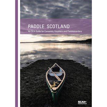
Previously published under the title Scottish Canoe Touring, this is a completely redesigned, revised and updated 2nd edition. Where can I go paddling? Find the answers right here, with 135 great canoe, kayak and paddleboard trips, 12 cross-Scotland routes, and numerous short easy trips in a unique guide for those seeking gentler waters. This guide is aimed at those looking for calmer waters - rivers, canals, inland lochs and sheltered sea lochs. Routes described cater for all tastes, from those seeking an idyllic afternoon's paddle to those looking for a multi-day canoe-camping expedition.
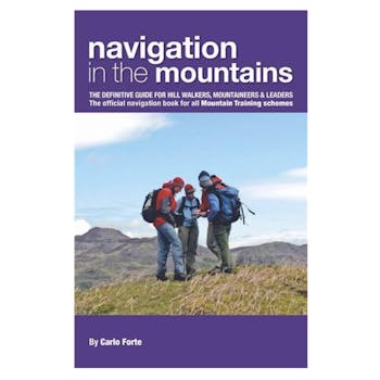
Written by one of the best known navigation instructors in the UK this is the definitive and comprehensive 'how to navigate' textbook. It covers every aspect of mountain navigation; summer, winter and overseas, using traditional map and compass as well as devices such as GPS and digital software applications. This book is a reference tool for every walker and mountaineer, from novice to expert, as well as containing specific ideas for anyone wanting to help teach and instruct others. It is the official navigation handbook for the UK qualification system that includes the Mountain Leader, Winter Mountain Leader, International Mountain Leader, Mountaineering Instructor and Walking Group Leader and is endorsed by the BMC, MCofS and MI. There are chapters on the Fundamentals, Navigation Techniques, Winter Navigation, Overseas Navigation, Global Positioning system, Digital Mapping Software and Teaching Navigation. It has a functional design with easy-reference colour-coded pages, striking illustrations that complement the text and inspiring photos that give a genuine flavour of what you are up against in the mountains. It is the fourth in a series of manuals from Mountain Leader Training UK which includes the highly successful 'Hill Walking', 'Rock Climbing' and 'Winter Skills'. Carlo Forte is a well known expert on mountain navigation and is an International Mountain Leader and Mountaineering Instructor. He is currently the Chief Instructor at the national mountain centre, Plas y Brenin.
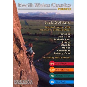
Classic routes of the Welsh mountains. Produced in a handy A6 size pocket format for carrying up routes. Large photo-topos supported by full descriptions and accurate approach maps. Areas Covered: Tremadog, Cwm Silyn, Llanberis Pass, Cloggy, Lliwedd, Tryfan, Idwal, Carneddau The guide does full-colour justice to several cliffs never before documented with topos, such as Little Tryfan and the Upper Tier of Tremadog. North Wales Classics is the indispensable companion to your Welsh mountain adventures.
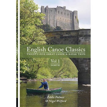
English Canoe Classics is an illustrated guide to some of the finest tours of northern England's waterways, from the North Tyne in Northumbria to the Shropshire Union Canal in the West Midlands. Scenic lakes, placid canals and broad rivers, as they can only be seen from a canoe or kayak. Eddie and 'Wilf' have chosen the best inland touring routes. They are described in great detail and illustrated with numerous colour photos and maps. The selected routes are suitable for open canoes, sit-on-tops and touring kayaks. Many of them can be tackled as a single voyage or a series of day trips, with campsites en route. The journeys are all accessible but highly varied, taking place on lakes, sheltered coastline, rivers and canals. A wonderful book for planning voyages and inspiring dreams, or sharing your experiences with others. Eddie Palmer bought his first kayak over 50 years ago. It was a wood and canvas one in which he set out to paddle rivers in his part of middle England and Wales. Since then, he has kayaked and canoed extensively in the UK, Ireland, western and eastern Europe, the USA and Canada and southern Africa. His passion over the past few years has been for long-distance canoe-camping. After a competitive career in slalom and whitewater racing, he still paddles whitewater. Eddie is a Board Director of the SCA and is the co-author of Scottish Canoe Touring, author of Scottish Canoe Classics and co-author of Irish Canoe Classics (all published by Pesda Press). Nigel Wilford has been involved with canoeing for most of his adult life, paddling throughout the UK, mainland Europe, Canada, USA and New Zealand. Born in northwest Leicestershire, his first canoe experience was on the gentle River Soar. Not long after, he moved to Yorkshire to attend university. The enjoyment he found while paddling the rivers of the northeast firmly established canoeing as his activity of choice. In 1991 he joined the British Canoe Union's coaching service, helping others to improve their canoeing or to become better coaches. Nigel has held various roles within the BCU including Local Coaching Organiser and English Whitewater Safety Coordinator. He is a BCU Level 5 Coach and member of Team Pyranha.
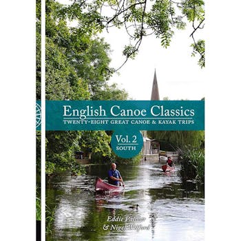
An illustrated guide to some of the finest tours of southern England's waterways, from the Grand Union Canal in the South Midlands to the River Tamar in the South West. Scenic lakes, placid canals and broad rivers, as they can only be seen from a canoe or kayak. Eddie and 'Wilf' have chosen the best inland touring routes. They are described in great detail and illustrated with numerous colour photos and maps. The selected routes are suitable for open canoes, sit-on-tops and touring kayaks. Many of them can be tackled as a single voyage or a series of day trips, with campsites en route. The journeys are all accessible but highly varied, taking place on lakes, sheltered coastline, rivers and canals. A wonderful book for planning voyages and inspiring dreams, or sharing your experiences with others. Eddie Palmer bought his first kayak over 50 years ago. It was a wood and canvas one in which he set out to paddle rivers in his part of middle England and Wales. Since then, he has kayaked and canoed extensively in the UK, Ireland, western and eastern Europe, the USA and Canada and southern Africa. His passion over the past few years has been for long-distance canoe-camping. After a competitive career in slalom and whitewater racing, he still paddles whitewater. Eddie is a Board Director of the SCA and is the co-author of Scottish Canoe Touring, author of Scottish Canoe Classics and co-author of Irish Canoe Classics (all published by Pesda Press). Nigel Wilford has been involved with canoeing for most of his adult life, paddling throughout the UK, mainland Europe, Canada, USA and New Zealand. In 1991 he joined the British Canoe Union's coaching service, helping others to improve their canoeing or to become better coaches. Nigel has held various roles within the BCU including Local Coaching Organiser and English Whitewater Safety Coordinator. He is a BCU Level 5 Coach and member of Team Pyranha.
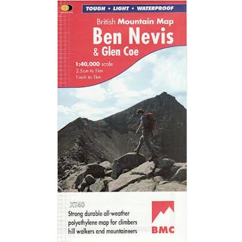
Waterproof mountain map of Ben Nevis & Glen Coe from Harvey at 1:40,000, with a geological map of the region on the reverse, an enlargement of Ben Nevis’ summit, and advice on navigating the region safely.
MAIN MAP:
Topography is shown through clear altitude shading, spot heights, contours at 15m intervals, and index contours at 75m intervals. A variety of symbols are used to show terrain detail, such as caves/mines, major and climbing crags, shafts, sinkholes, cairns, and large boulders. The map is GPS compatible, with the National Grid overprinted on the cartography.
Rights of way shown include tracks, long distance and intermittent paths. Road detail includes minor, residential and forest roads; railway lines and stops are marked, as are chairlifts and ski tows. Points of interest and facilities such as campsites, information points, and mountain rescue post are prominently highlighted.
ENLARGEMENTS: The summit of Ben Nevis is shown at 1:15,000, with a description of how to get to and from the summit.
GEOLOGICAL MAP:
The reverse shows a geological map of the region from the British Geological Survey, with detailed relief shading and colours used to denote different types of rock. There is additional written geological information, as well as a geological timeline of the region.
ADDITIONAL INFORMATION: There is also information on emergency procedures, navigating the region safely, and useful contact numbers are provided. There are also lists of local climbing venues, mountaineering club huts, and mountain bothies.
Printed on tough, hard-wearing polyethylene, the map is waterproof, and tear-resistant, and comes in a clear plastic wallet.